Map
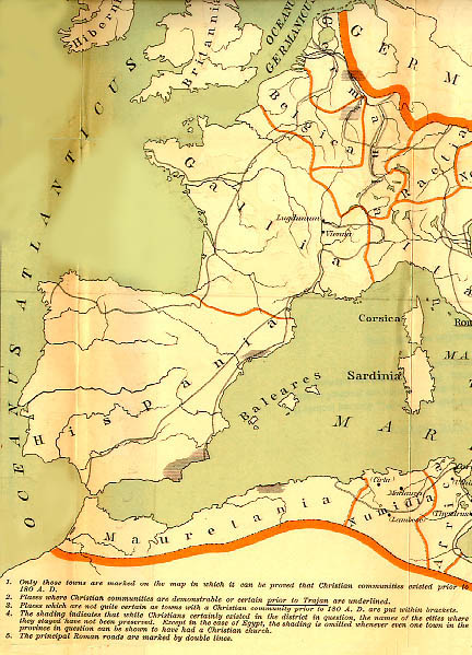
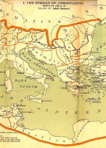
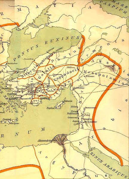
1. The Spread of Christianity down to 180 A.D.
Full Size
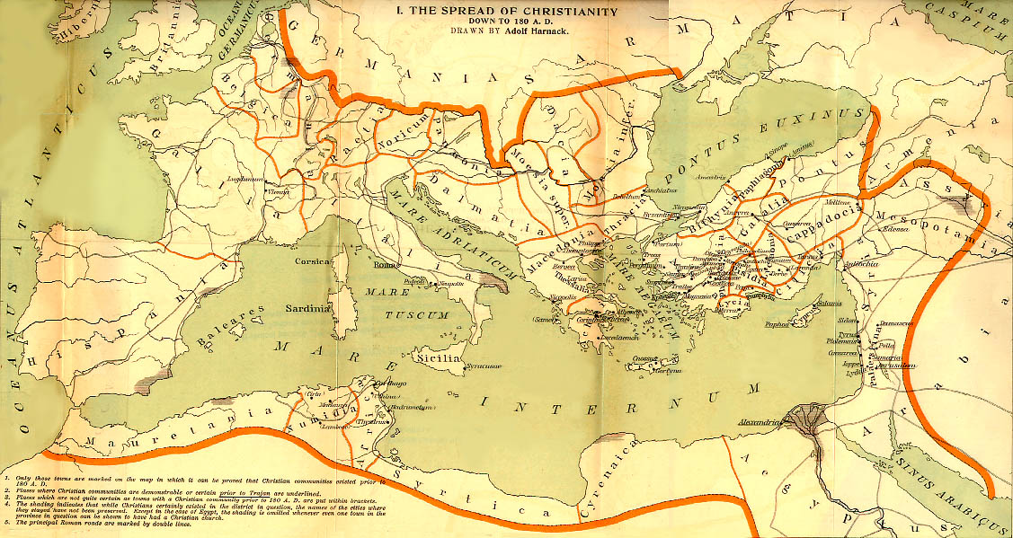
Caption
- Only those towns are marked on the map in which it can be proved
that Christian communities existed prior to 180 A.D.
- Places where Christian communities are demonstrable or certain
prior to Trajan are underlined.
- Places which are not quite ceratin as towns with a Christian
community prior to 180 A. D. are put within brackets.
- The shading indicates that while Christian certainly existed in the
district in question, the names of the cities where they stayed have not
been preserved. Except in the case of Egypt, the shading is omitted
whenever even one town in the province in question can be shown to have
had a Christian church.
- The principal Roman roads are marked by double lines.
Credits
This map was drawn by Adolf Harnack and has
been digitized from Adolf Harnack, The Mission and Expansion of
Christianity in the First Three Centuries, translated and edited by
James Moffatt, second edition, vol. 2 (New York: G. P. Putnam's Sons,
1908).
Because of the time elapsed since the copyright date, these
maps are now in the public domain.
Other Forms
The map is available in the following forms:
More public domain maps
10/15/97
Jay Treat