About 250 meters round trip; unpaved, steep but short slope
The landscape you see today is quite different from the one of 2500, 250, and even 25 years ago. Present-day conditions provide a baseline from which archaeological reconstructions are created. After you take this tour, you may find it easier to imagine how people have altered the vegetation and even landforms. As you look around, traces of the past are still visible on the land today. If you have time, you might want to try the Tumulus MM circuit, South Ridge tour, or Citadel Mound circuit supplement.
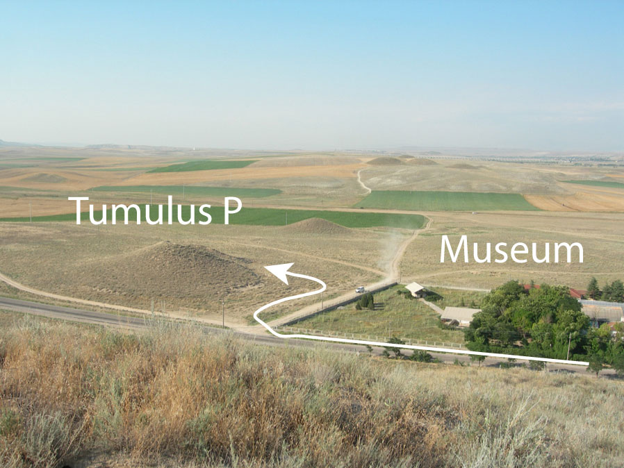
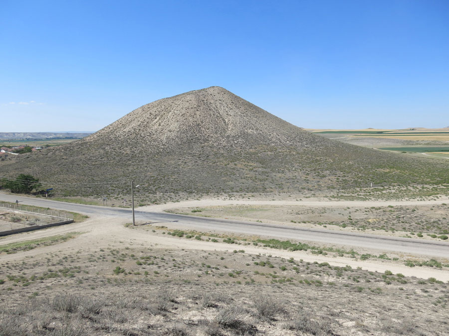
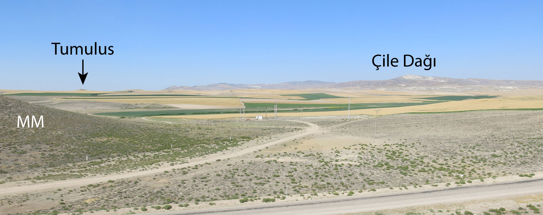
Preview/summary: The tour takes you to the top of Tumulus P (next to the museum), where you can look around at the modern landscape. As you leave the museum grounds, Tumulus MM is straight ahead, but for Tumulus P, turn right. A small native plant garden is on the corner at the end of the garden; Tumulus P is ahead to the right. Make your way to the back (south) side of the tumulus, climb to the top and look around. Tumulus P is the best place to get a good photograph of Tumulus MM. Starting there (you will be facing north), turn your gaze in a counter-clockwise direction. The mountain to the northeast is Çile Dağı, and the one to the southeast is Dua Tepe. The South ridge has several tumuli, and beyond is Beylikköprü and the Eskişehir road. Toward the west on the present-day plain is the archaeological site of Gordion. The Gordion Museum and native plant garden is to the northwest. Then, as you make your way down from Tumulus P, you might be inspired to see what you can see from the south ridge, or see what's on the other side of Tumulus MM.
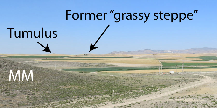
As you leave the museum grounds, Tumulus MM is straight ahead
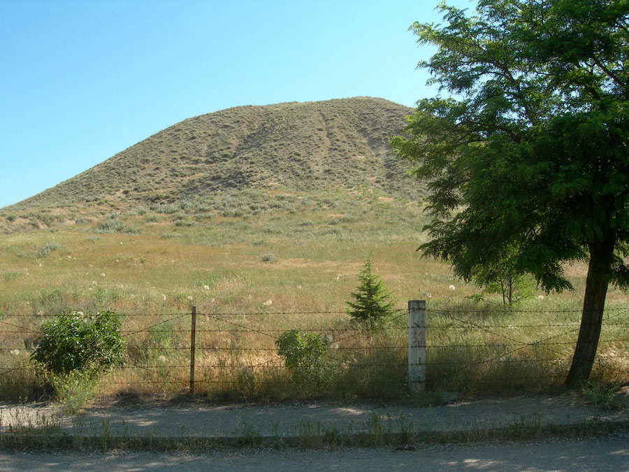
Why is there a fence around this tumulus?
We hope to slow erosion by improving the vegetation cover. The fence
protects plants from trampling by people and grazing by animals. Thank you
for not walking on the mound.
Turn right and walk along the road
A small native plant garden is on the corner at the end of the museum
grounds. Check it out when you return to the Museum.
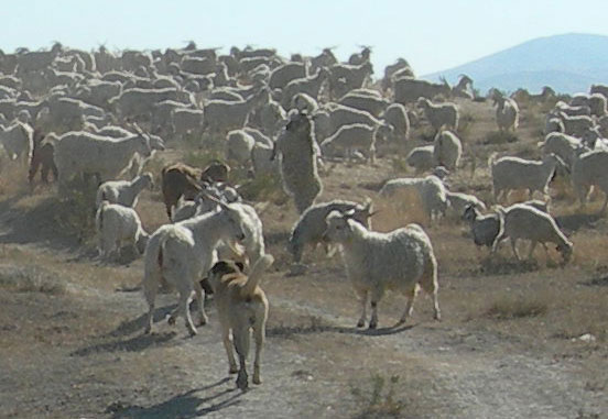
If you see a flock of sheep or goats...
Be aware that there may also be a dog of the same general size, shape, and
color. DO NOT get between the dog and its flock.
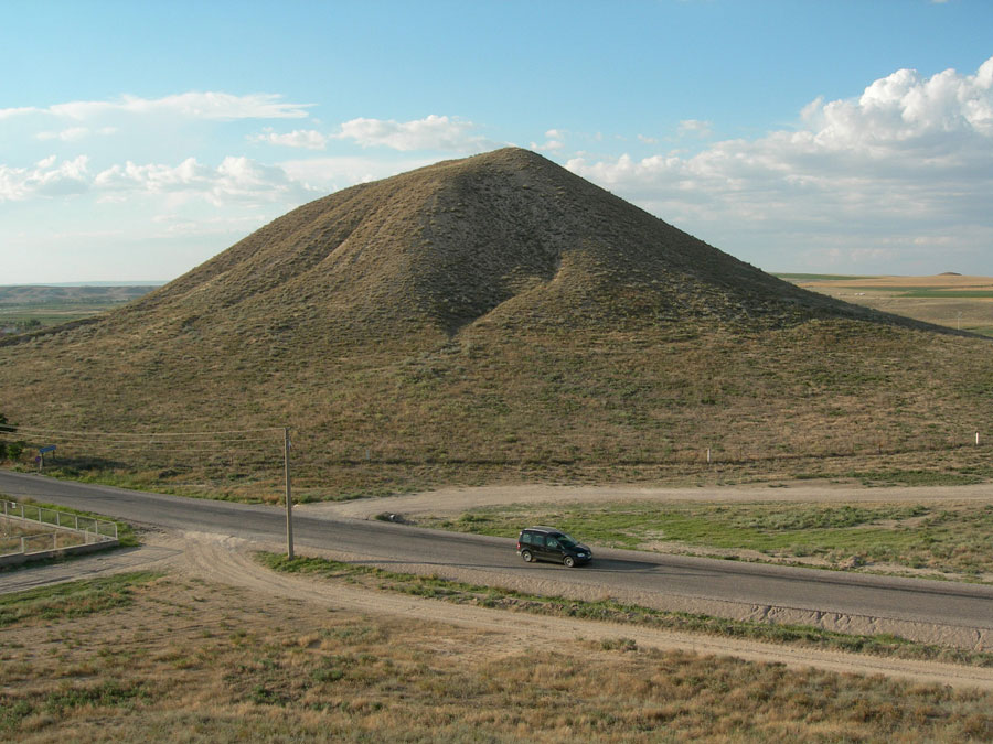
As you pass the garden, Tumulus P lies ahead of you on the right
Make your way around to the "back" (south) side of the tumulus. Climb to
the top and look around.
Tumulus P was excavated in 1956. The Museum backfilled the excavation cut in
2002, so it will not harm the tumulus to walk on that side.
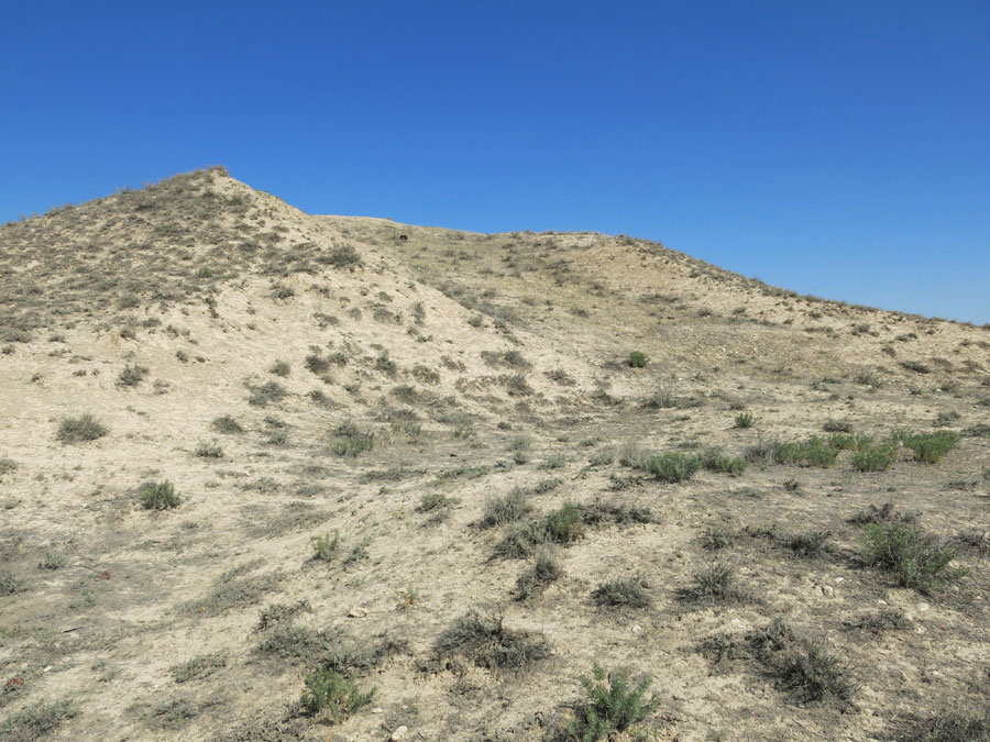
As you walk up the slope, notice how plants have filled in over the bare earth.
Plants of disturbed ground (‘ruderals’) were the first to move in. By the time
you read this, you can see that as the surface stabilizes, some plants that
grow on the unexcavated portion of the mound can gain a foothold. If you
decide to climb Tumulus P, please go along the “back” side (away from the
road), where the soil is backfill.
For the rest of the tour, turn clockwise for each new segment
The mountain to the northeast (Çile Dağı) is geologically
basalt. The town of Ayaş is about 30 km away on the far side of the
mountain. Water from the Ayaş hotsprings is piped in for the spa in the
oversized hotel that sits on the valley floor.
Follow the horizon line downslope from Çile Dağı
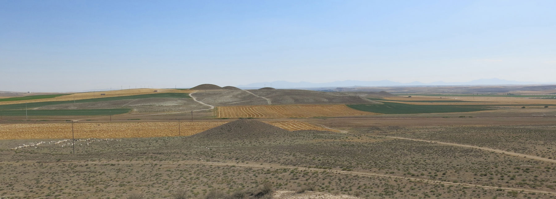
You can see the Beyceğiz tumulus. Toward the southeast, the main area of
tumuli comes into view; Tumulus W is the second-largest in the immmediate area.
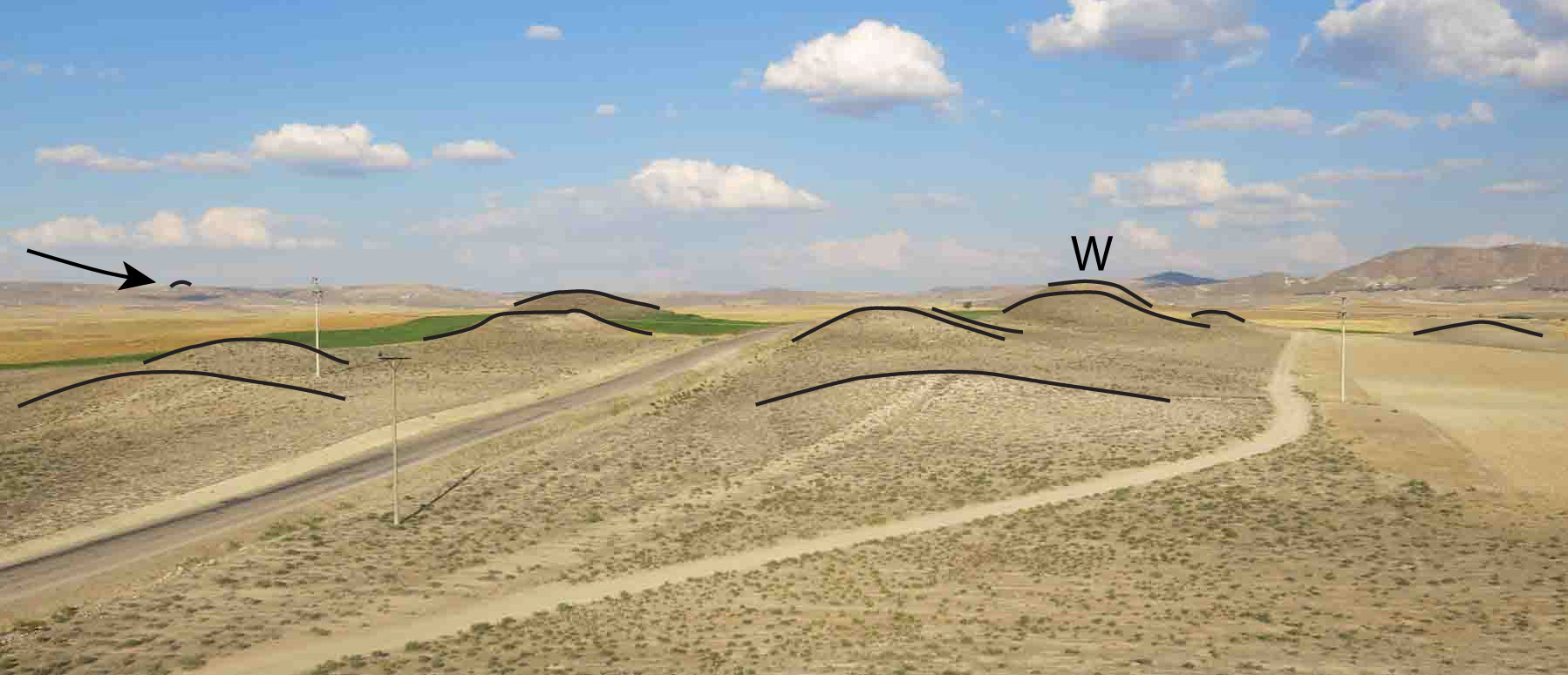
The tumuli that are surrounded by fields are gradually being destroyed by deep
plowing and irrigation. Even the ones on unplowed pasture land, like Tumulus P
and the ones in the foreground, may be cut into by roads. The effects of
irrigation extend beyond the fields themselves; as the fields encroach on the
tumuli, the natural vegetation, which is well-adapted to dry steppe
conditions, cannot compete with invasive field weeds.
The mountain to the southeast is Dua Tepe
The village of Çekirdeksiz nestles on the lower slopes of Dua Tepe along a
line of springs. Today the slopes are heavily eroded due to deforestation. The
red basalt soils of Dua Tepe form a deposit as much as 4 m deep in the center
of the plain below.
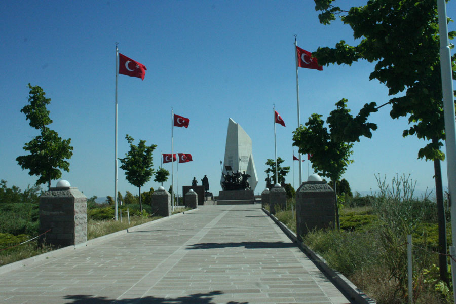
Dua Tepe
The top of Dua Tepe was General Mustafa Kemal Atatürk's lookout point
during the Battle of the Sakarya (August 23-September 13, 1921).
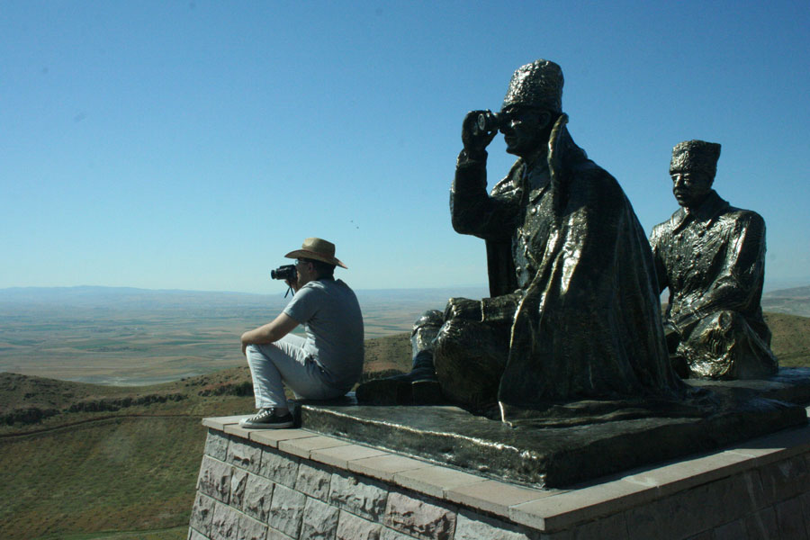
The battle was a turning point in the Greco-Turkish war, part of the Turkish
War of Independence. This place is where Atatürk’s troops turned back the
Greek forces. The memorial to that battle commands the summit of Dua Tepe,
providing a 360° view of the region. It is accessible by automobile.
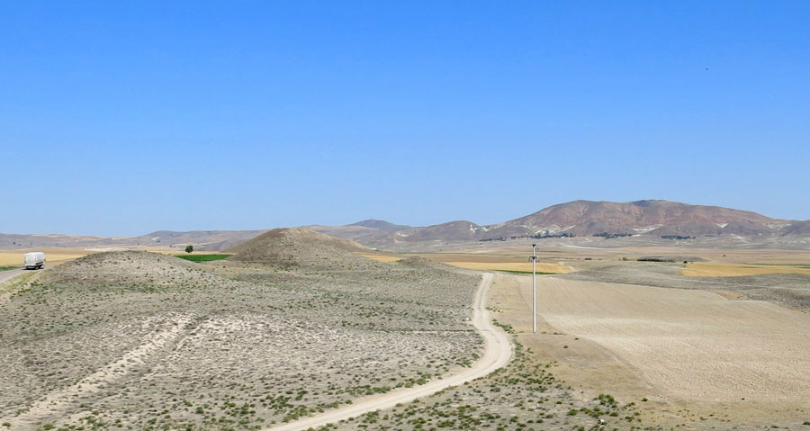
The South Ridge has several tumuli, and beyond is Beylikköprü and the Eskişehir road
 There is a small tumulus right in front of you, and Another group of tumuli
along the ridge to the south. The south ridge is 10 to 15 minutes on foot from
Tumulus P, and affords another view of this ancient landscape. The low-lying
area between Tumulus P and the South Ridge is filled with soil from the Dua
Tepe upland. In reconstructing the ancient landscape, it is important to
remember that today’s landforms could be recent, as in this case.
There is a small tumulus right in front of you, and Another group of tumuli
along the ridge to the south. The south ridge is 10 to 15 minutes on foot from
Tumulus P, and affords another view of this ancient landscape. The low-lying
area between Tumulus P and the South Ridge is filled with soil from the Dua
Tepe upland. In reconstructing the ancient landscape, it is important to
remember that today’s landforms could be recent, as in this case.
Toward the west on the present-day plain is the archaeological site of Gordion
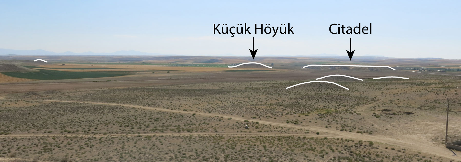
Despite the 4-meter deep deposit on the plain that lies before you,
archaeologists have found evidence of settlement between here and the flat
Citadel Mound. In the first millennium BC, the Sakarya river ran along this
side of the site.
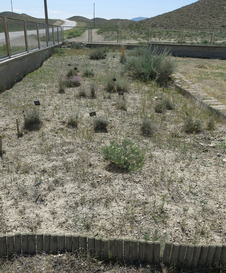
The Gordion Museum and native plant garden are to the northwest
To see some native plants and the natural vegetation of this area, a good place
to start is the Museum garden. In the fall of 2006, we established an
experimental plot just across the street from the Midas Tumulus. We have
planted some of the native plants that grow within the fenced area of the
Midas Tumulus, including perennial feather grass. If you have more energy,
take a 600-meter walk around the tumulus. If you look carefully, you will see
that the vegetation changes depending on elevation and aspect. Around the left
of the entrance, the north and west have the most lush plant cover, and around
the right, the south and east, have the least.
As you make your way down from Tumulus P, you might be inspired to walk around Tumulus MM, or see what you can see from the south ridge. See related tours .
The changing landscape
Plant and animal remains from the Gordion excavations give us a picture of
the ancient landscape.* Autumn-sown and spring-harvested wheat and barley grew
in unirrigated fields around the settlement at Gordion. Flocks of sheep and
goats grazed on lush pasture. On the slopes nearby, small oak and junipers
grew among the grasses and other plants. When the Phrygian kings built the
first tumuli (burial mounds) nearly 3000 years ago, the soils on the
mountainsides supported oak and juniper woodland. At some point in the past
1500 years, people cut down the trees, over-grazing destroyed the vegetation
cover, and the soil washed down into the valley. About 1000 years ago, the
farmers began growing a few summer-irrigated crops.
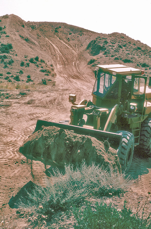
That economy lasted for almost 1000 years. Modern technology (tractors and
pumps) shifted the balance away from herding and towards farming, but change
occurred slowly until the late 1990s. At that time, a major water project
allowed farmers to irrigate the high slopes. Pasture is rapidly being
converted to fields, and the farmers are plowing and irrigating most of the
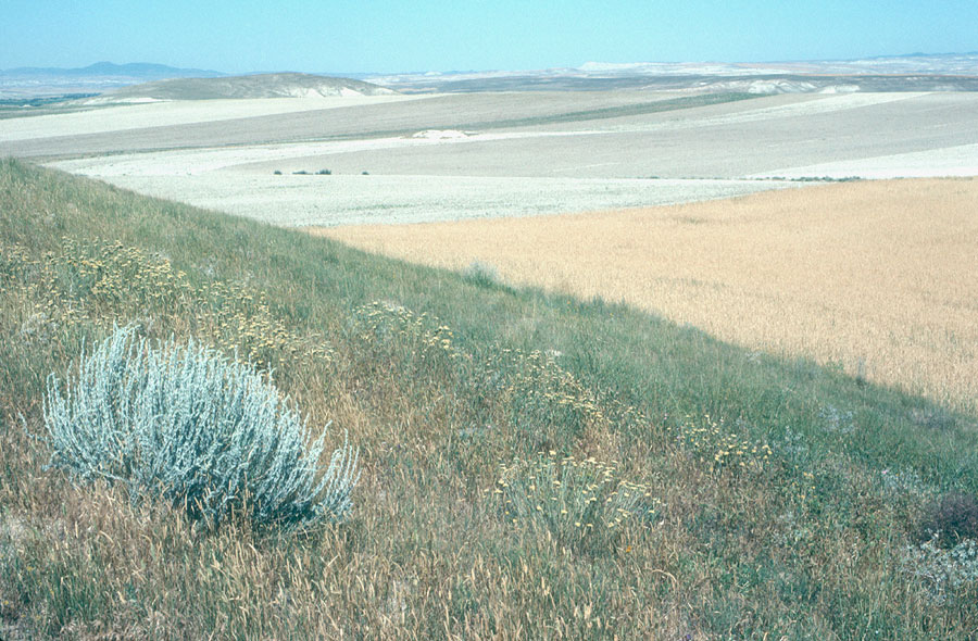
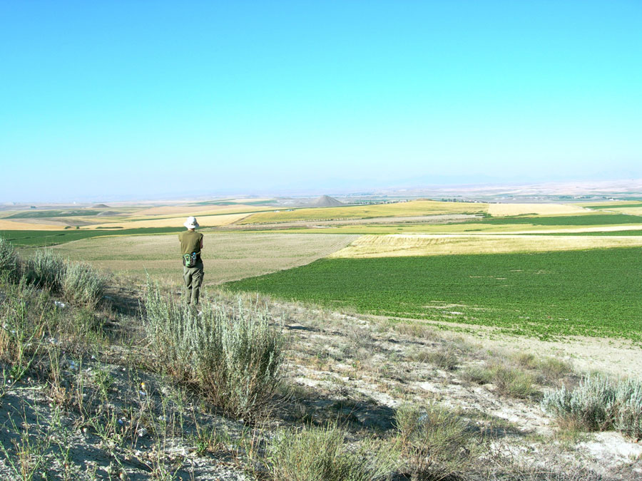
ancient tumuli as well. (These photographs illustrate a patch of grassy steppe
in 1992, surrounded by unirrigated fields, and in 2007, surrounded by (now)
irrigated fields; tractors, excess water, and increased human activity have
destroyed this rare and delicate habitat.
* Evidence for this reconstruction comes from the analysis of animal bone and charred seeds and wood from the Gordion excavation. People cut wood fuel close to home, as it was expensive to transport. As trees were cut down, people went further for wood and began to use an alternative fuel-animal dung-that contained seeds. Archaeobotanists ask: Does the proportion of seeds (indicative of dung fuel) increase or decrease relative to wood fuel? The different seed types tell us what the animals ate: were they sent to pasture? fed cultivated grain? Sheep and goat bones are most common when seeds of wild pasture plants are most common; high proportions of cattle and pig bones are associated with botanical indicators of agricultural production.
NOTE: I prepared this walking tour in the summer, 2014. It is based on many
publications and conversations over the years with the following people: Ayşe
Gürsan-Salzmann, Ben Marsh, Mecit Vural, and many Gordion team members. If you
have any comments or corrections, feel free to contact me at
< nmiller0@sas.upenn.edu >. Fieldwork for this project was funded by the
University of Pennsylvania Museum,
Philadelphia. The views expressed here are mine alone.
Naomi F. Miller,
July, 2014
www.sas.upenn.edu/~nmiller0/Tour_TumP.html